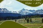
Idaho Hiking Trails
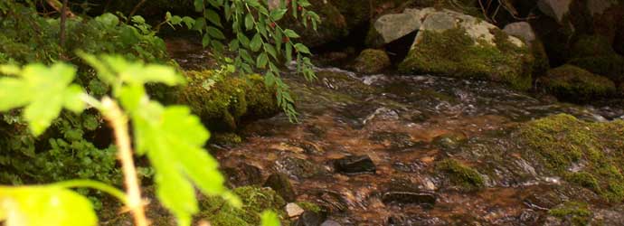
Many Idaho hiking trails surround Wagonhammer and RV Park and Campgrounds is a great spot for many seeking backpacking and hiking adventures. Bring your RV, camper or tent or if you would like to travel light, experience a true rustic vacation when you stay in one of our teepees with access to our modern amenities, such as our #10 rated Restrooms and Showers facilities Venture out on many nearby Idaho’s best hiking trails offering both relaxing and challenging hikes, and return to Wagonhammer to recharge before you set out on another backcountry trail.
Enjoying nature is made easy with the numerous Idaho hiking trails available throughout the area. Take a picnic lunch and walk the 300 yards to the trails of Wagonhammer Springs Canyon, or explore the Lewis & Clark trails which they traveled beginning at the mouth of Thompson Gulch.
 Idaho hiking trails near Wagonhammer Campground


As you hike, keep your eyes open for the native wildlife, including big horn sheep, mountain goats, elk, deer and moose. There are also many species of birds and waterfowl such as Clark’s nutcracker and the Red Monkeyflower. If you are more into riding rather than walking, there are many trails ideal for mountain biking, horseback riding and 4-wheeling. Wagonhammer Springs Canyon provides a well-established trail, while one trail is just two miles from the campground and leads bikers to the River of No Return. For rock hounder’s and pebble puppies, the area is brimming with petrified wood, opal, and agate, all within an 80 mile radius. If you want to stick closer to home, then the campground offers Montana Sapphire gravel for panning. Guests of Wagonhammer RV Park and Campground can also enjoy white water canoeing and whitewater river rafting; bring your own boats or rent them from a local outfitter.
Camper Reviews – Our Guests Say it Best!
“Wagonhammer RV Park – a beautiful oasis along the Salmon River! An awesome view of the Salmon Range is a treat to wake up to.”
Maureen Lopez, TX
Hiking Trails near North Fork Idaho
- Ditch Creek – Hike 7 miles from Hughes Creek Road #088, then right onto Ditch Creek Road #089 for 5.4 miles This is a steady uphill climb beginning at 6,800 feet elevation. Find great scenic views and fishing along the way.
- Divide Trail – Travel 13.5 miles from Chief Joseph Pass to Big Hole. Trail #6106 crosses Highway 43 and heads south. Follow Continental Divide Trail symbols. Motorized use allowed on trail. Outstanding views.
- Divide Trail – Beginning at the Lost Trail Ski Area, follow Forest Service Road #081 toward Saddle Mountain for 1.5 miles. Trail # 6106 is on the left and follows the ridge top for 5.5 miles joining with Twin Creek Ridge Trail #6109. Motorized use allowed. Outstanding views.
- Horse Creek – Begin 5 miles beyond Horse Creek Hot Springs, follow Trail #6159 for 16 miles until junction of Salmon River Trail #6162. Elevation 5,650 feet. Road access is fair in dry weather. Fishing.
- Reynolds Lake – Hike 1.5 miles to Reynolds Lake on Forest Road #044 to trailhead. Trail #6158 is relatively easy beginning at 7,300 feet elevation. Located in the Frank Church River of No Return Wilderness. Fish and scenic views abound.
- Salmon River Trail – Travel 67 miles on the Salmon River Road to Corn Creek. Trail #6162 borders the Salmon River access to the lower end of Horse Creek #6159, Eakin Ridge Trail #6006 and Dwyer Smith Trail #6114. Swimming and fishing can also be enjoyed.
- Spring Creek – From North Fork, Idaho, go 18 miles west turn right Spring Creek Rd and head up to miles of many dirt roads, jeep trails, and single track trails to explore.
- Stoddard Trail – Follow the Salmon River Road from North Fork to Stoddard Trailhead. Trail #6169 starts at 3,000 feet elevation and joins with Cottonwood Butte Trail #168. View the incredible vastness and beauty of the Middle Fork and Salmon River drainages.
- Twin Creek Ridge – Travel 36.2 miles from Salmon, Idaho on Hwy 93, turn at Twin Creek campgrounds; pass campgrounds until road forks. Trail #6109 begins as an old logging road and is a moderate uphill climb. Elevation 5,350 to 8,190 feet. Motorized use allowed on trail.
- Wagonhammer Springs Canyon – Just 300 yards from Wagonhammer RV Park and Campground are 50 miles of adventurous hiking trails. Hike the 2 miles to Thompson Gulch and follow marked trail on left to travel one of Lewis and Clark Trails.
Hiking Day Use Areas
- Perreau Creek – Take HWY 93 to Shoup turn off, cross bridge; drive to Perreau Creek Road #027, continue on road to bottom of road and hike past houses to trail. Trail #078
- Haynes Creek – Turn off of Hwy 28 at 17 mile; follow road to pond and hike along creek. Trail #960; Road #427
- Williams Lake – Take Hwy 93 So, turn right at Shoup Bridge, turn left at County Road to Williams Lake. From boat launch, hike around lake. No trail or road number.
- Wagonhammer – Take Hwy 93 north to Wagonhammer Springs Park and hike behind gate. Trail #137; Road #072
You are welcome to review a more complete listing of hiking trails when you stay at Wagonhammer RV Park and Campgrounds.